


Soils and water: the hidden history below ground at Foxearth Meadows
by Mark Prina, Reserve Manager of A Rocha UK.
At Foxearth Meadows we manage a patchwork of different habitats and structure – a haven for specialist plant communities and their associated invertebrate species, underpinning a thriving diversity of bird, mammal, reptile, amphibian and fish populations. However, I would be deceiving myself if I concluded that it is our noble efforts that create the richness and variety that we encounter. Whatever one does on the surface there are many unseen factors at play below ground.
I have recently been literally unearthing the much longer history that is preserved below ground which is giving clues to the vegetation patterns seen at Foxearth Meadows. Observing the vegetation on the meadow and how one stand of a dominant species suddenly changes to another and then to much more diverse flora I have been asking – why? We decided to install a dipwell system to measure changes in the ground water levels and see if that was a significant factor in the distribution of different plant communities. Basically, this is removing a 4 foot deep soil core sample using a soil auger and placing a perforated plastic pipe in the vacant hole. The ground water levels can then be measured in the pipe to reveal changes over time. For this task I am grateful to Paul Burgess for making an electronic ‘buzz stick’ measuring device. I currently delight in demonstrating this to allcomers whether young or old or whether they realise yet how fascinating hydrology is!
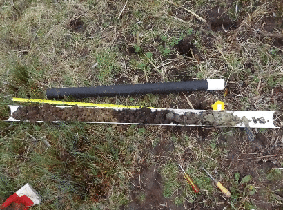
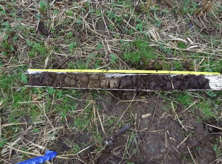
The soil cores were then studied to see the different layers formed since the last Ice Age 11500 years ago. It is like opening a history book and gaining a humbling glimpse at how our precious soils were made and how long that takes. At that time there would have been huge flows of water from the melting snow and ice even though the meadow is south of the glaciated region in Britain.
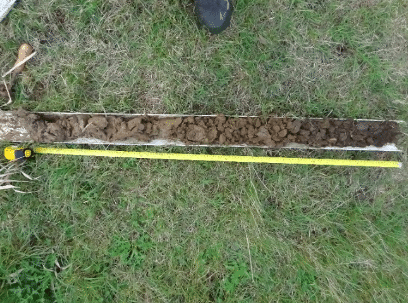
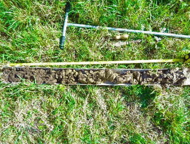
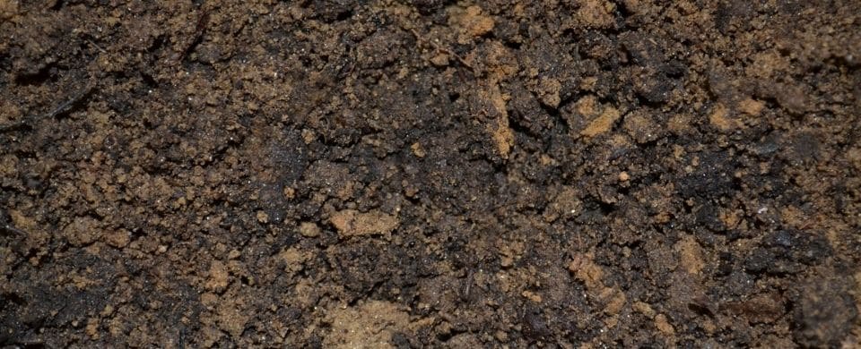
This explains the layers of sand and gravel laid down by rivers on floodplains such as at Foxearth Meadows. It was apparent that we have thick clay nearer to the River Stour (Figs.2 & 3) which changes to deeper loams, less clay, peat and sand layers as one moves away from the river (Figs.4 & 5). These changing soils and water content support different plant communities. When I predicted that under areas where Fen Bedstraw and Blunt-flowered Rush grow I would find peat and that was the case I was amazed how excited I was. I am now a soil science enthusiast and will spend much time looking below ground as well as above it. I am left with a realisation that to preserve our amazing plant life we have to look after the precious soils formed over such huge expanses of time. Once they’re gone they’re gone. It is now recognised that complex floodplain soils store enormous quantities of carbon which in this time of climate change concern is another compelling reason for theirs, and indeed all soils’, preservation.
I have discussed the soil survey and the future long-term monitoring of the water levels at Foxearth Meadows but another avenue of investigation are the sources of the water supply to the floodplain. We have been building a picture of the hydrology through: studying the influence of the western ditch draining arable land on higher ground to the south-west; the effects of digging surface ‘foot drains’ or ‘grips’ to return flood waters to the river; digging test pits along the back of the floodplain to reveal the flow onto the meadow through aquifers. The picture unfolding is that the River Stour is a factor at times of flood but that water is not moving from the river through the clay soils easily at times of normal flow. The flow through aquifers, probably gravel beds (terrace deposits), from under the adjacent arable field seems more significant. Test pits dug along the boundary with the arable land show water constantly moving through soil onto the floodplain. I had not expected this but it explains the marshy nature of the areas furthest from the river with their complex soils.
Every investigation of course begets another and we will certainly extend the soil survey to sample the site on a grid basis and ultimately produce a soil map. Our hydrological studies beg the question, how can we control the water supply onto and leaving the site? There are natural processes at work but also influences from previous water management regimes – filling in a drain with spoil does not remove its effects on water movement. The two 1980s gravel pits have their own effects. Unravelling these recent interventions which include, unfortunately, ploughing (1980s again) will hopefully take us nearer to the traditional floodplain management that must have taken place over previous centuries. An hour or two spent in the county records office may prove enlightening.
Above ground we will continue to see people coming and engaging with this special place and its wildlife but I am now aware that without the unseen earthy and watery world below ground none of that would be possible.
Originally written for our quarterly Foxearth Meadows news and prayer letter (Winter 2021). Sign up to receive future emails here.